Lake Grace Airstrip
The Lake Grace airstrip is an unlicensed gravel airstrip located approximately 8 km West of the Lake Grace town site on the Lake Grace-Dumbleyung Road.
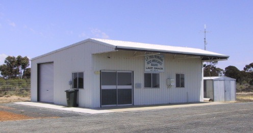
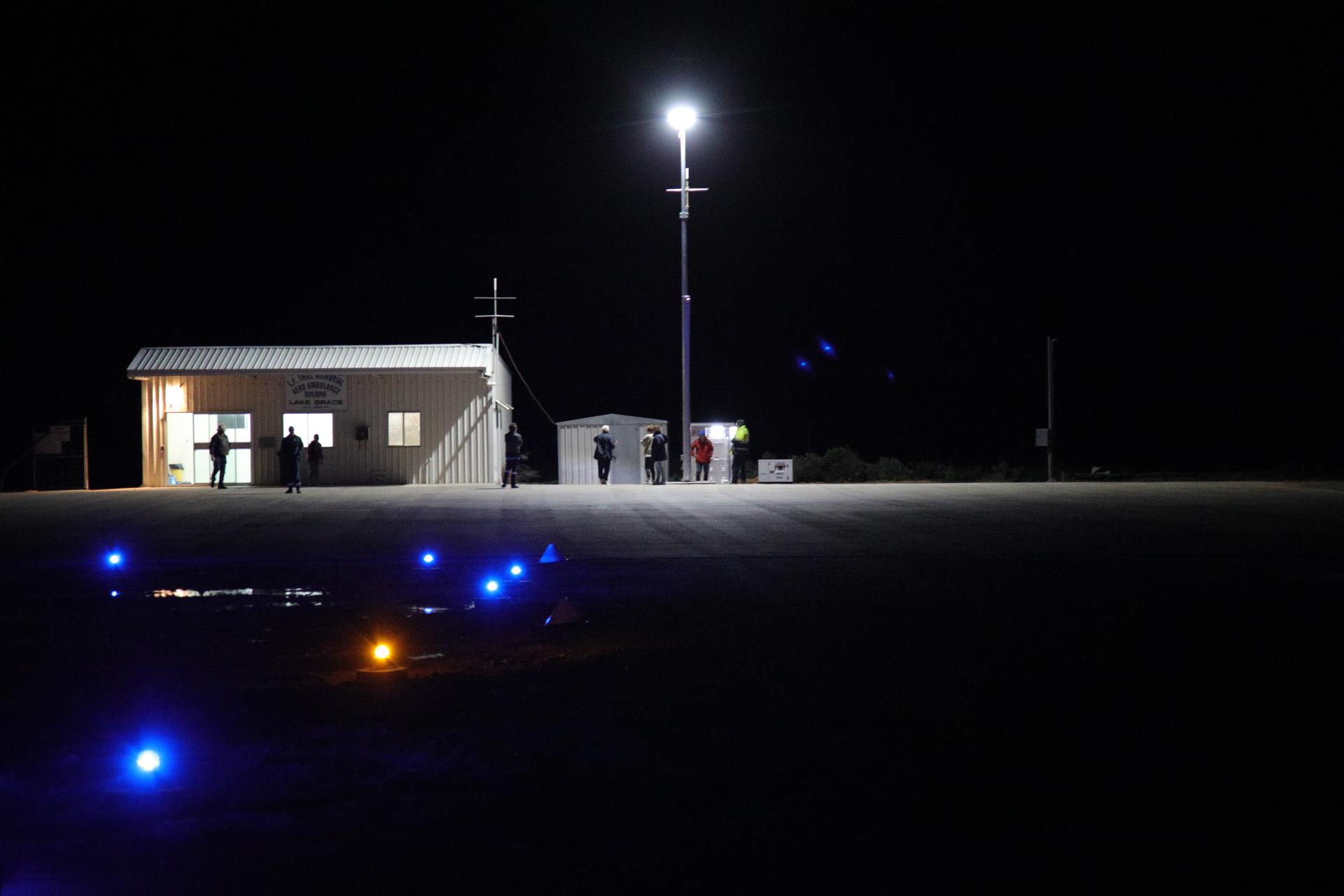
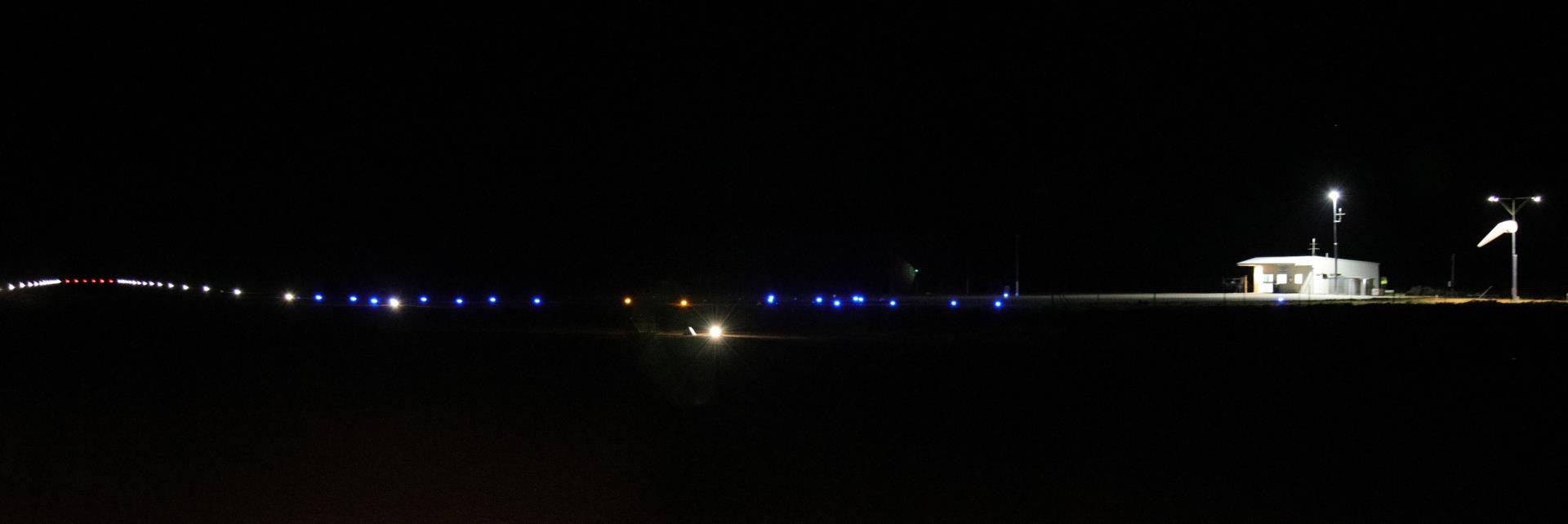
This facility consists of one 1200m airstrip, with 50m sealed hardstand areas at each end, low intensity pilot-activated runway lights, and a small clubroom (pictured above).
| Name |
Lake Grace |
| Identifier |
YLGC |
| Type of Airfield |
Unlicensed |
| Landing Permission |
Not Required |
| Landing Fees |
Nil |
| Latitude |
33 06.44 S |
| Longitude |
118 23.19 E |
| Magnetic Variation |
2 W |
| Elevation |
935 ft |
| Runways |
11/29 Gravel w/ Sealed Ends 1200m |
| Lighting |
Low intensity RWY Lights |
| Lighting Activation Freq. |
119.65 MHz |
| Primary Windsock |
Adjacent to Airstrip |
| Secondary Windsock |
Adjacent to Entrance |
| Special Procedures |
Strip is adjacent to salt lake. Power lines on approach to Runway 29 (east end) |
| Fuel |
BP Ph: 08 9865 1221 |
| Facilities |
- Drinking Water
- Free local telephone calls
- Toilets
- Hardstand plane parking area
|
| Nearest Town |
Lake Grace 7.1 km E |
Please direct any enquiries to Council's Manager of Works and Services
Ph: 08 9890 2500
Fax: 08 9890 2599
Email: shire@lakegrace.wa.gov.au
Newdegate Airstrip
The Newdegate Airstrip is an unregistered intersecting runway 500m southwest from the Newdegate townsite. Its two runways track northwest/southeast and east-northeast/west-southwest. The surface is entirely gravel, with a small parking area close to the main road access.
There is no lighting on the runway so landing during the night is not advised. Permission is not required to land.
| Name |
Newdegate |
| Identifier |
YNGT |
| Type of Airfield |
Unlicensed |
| Landing Permission |
Not Required |
| Landing Fees |
Nil |
| Latitude |
33 06.265 S |
| Longitude |
119 01.084 E |
| Magnetic Variation |
|
| Elevation |
1,065 ft |
| Runways |
06/24 Gravel 900 m
14/32 Gravel 900 m |
| Lighting |
No lighting |
| Lighting Activation Freq. |
N/A |
| Primary Windsock |
Adjacent to Airstrip, east of intersection |
| Secondary Windsock |
Adjacent to Entrance, access to main road to the north |
| Special Procedures |
The airstrips are built on a hill, sloping upwards from the edges of the runway towards the intersection. Runway 32 (southeast end) threshold is displaced. |
| Fuel |
|
| Facilities |
None |
| Nearest Town |
Newdegate 0.5 km NE |
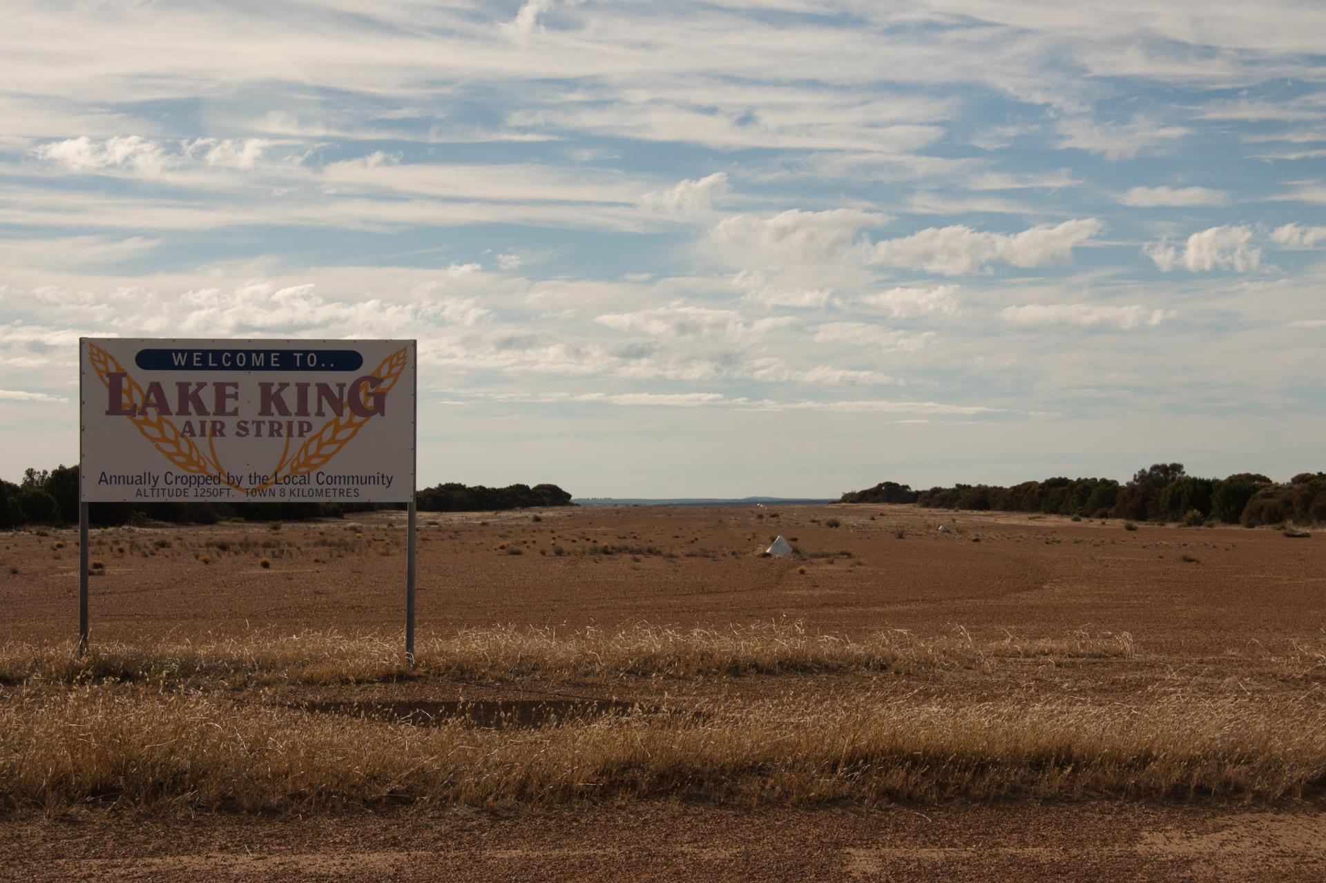
Lake King Airstrip
The Lake King Airstrip is an unregistered runway with offshoot 7.2 kilometres east from the Lake King townsite. The surface is entirely gravel mixed with dirt, with a small parking area close to the main road access.
There is no lighting on the runway so landing during the night is not advised. Permission is not required to land.
| Name |
Lake King |
| Identifier |
Nil |
| Type of Airfield |
Unlicensed |
| Landing Permission |
Not Required |
| Landing Fees |
Nil |
| Latitude |
33 04.782 S |
| Longitude |
119 45.984 E |
| Magnetic Variation |
|
| Elevation |
1,280 ft |
| Runways |
14/32 Gravel 1,000 m
18/36 Gravel 1,200 m |
| Lighting |
No lighting |
| Lighting Activation Freq. |
N/A |
| Primary Windsock |
Adjacent to Airstrip, south of intersection |
| Secondary Windsock |
Nil |
| Special Procedures |
Nil |
| Fuel |
|
| Facilities |
Water tank w/ swipecard access |
| Nearest Town |
Lake King 7.2 km W |