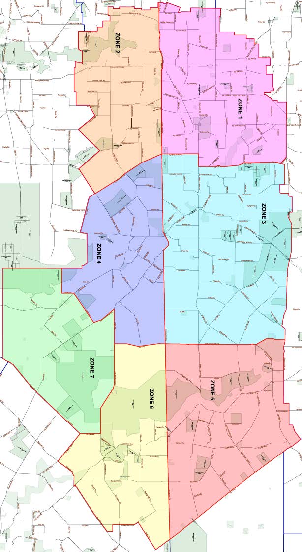
Fire Zones
Due to the size of the Shire and the varied weather patterns we experience, the Shire has been divided into 7 Fire Zones. These Zones allow the Fire Control Officers to apply Harvest and Vehicle Movement Bans (HVMB) to an area that is appropriate to the elevated conditions.
The Works and Infrastructure team also use these Zones to manage the closure of roads due to unfavourable weather events.
Please see below to download a geo-referenced PDF version of the Fire Zone map. This can be opened in the free mobile app Avenza, available from the iOS App Store and Google Play store. After loading the map file into the app, it will locate you on the map, showing your current location with respect to the fire zones.
Download the Zone Map Here: Shire of Lake Grace Fire Zones
Fire Response Support Map:
Download the BFB Map Here: Shire of Lake Grace BFB Map
Fire Zones (Harvest Ban Zones) - please click below to view an enlargement of specific zones: